
Chiapas Waterfalls: A Unique Geological Phenomenon
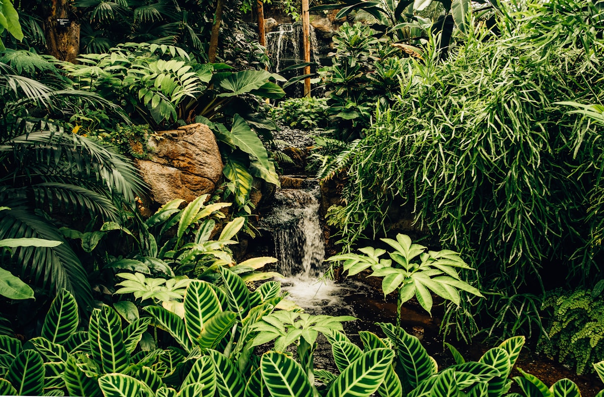
Chiapas is home to some of Mexico's most impressive and geologically fascinating waterfalls. This region, located in the country's southeast and characterized by rugged terrain and a tropical rainy climate, has created ideal conditions for the formation of spectacular waterfall systems and water bodies. Rivers descending from the mountains transport sediments and minerals that give these waterfalls their unique colors and distinctive geological formations.
Why does Chiapas have so many waterfalls? The state sits at the transition between Mexico's Central Plateau and the Coastal Plain. This steep topography, combined with annual rainfall exceeding 2,000 mm in some areas, creates the perfect stage for spectacular waterfalls. Major rivers like the Grijalva, the Usumacinta, and various tributaries continuously carve through limestone and volcanic terrain, generating water drops of impressive heights.
The mineral deposits that characterize several of these waterfalls come mainly from calcium and calcium carbonate present in groundwater. As water flows and is exposed to air, these minerals deposit on rocks and vegetation, creating natural terraces of characteristic turquoise-blue color. This process, known as travertinization, has been occurring for thousands of years, sculpting the unique landscapes we admire today.
Agua Azul: Mexico's Most Famous Turquoise Terraces
Agua Azul is probably Chiapas' most iconic waterfall and one of Mexico's most photographed. Located in Tumbalá municipality, 65 km from Palenque, this geological marvel consists of a series of jumps and natural terraces descending approximately 60 meters, forming 13 main levels. The name "Agua Azul" (Blue Water) is absolutely justified: the water displays intense, crystalline turquoise-blue color due to high concentrations of dissolved calcium carbonate in the Xanil River.
Specific geological data: Agua Azul formed on a limestone bedrock carved by water flow over millennia. Minerals dissolved in the water (mainly calcite) constantly deposit, creating new terraces and reinforcing existing ones. The main waterfall has a drop of approximately 25 meters, though there are multiple smaller falls distributed across the site's 800-meter extension. During rainy season (June to October), water volume increases considerably, making the spectacle even more impressive. In dry season (November to May), the blue color is more intense because there's less mud sedimentation.
Getting there: From Palenque it's 65 km by car, approximately 1.5 hours via Highway 199. From Tuxtla Gutiérrez it's 200 km, about 3.5 to 4 hours. Park entrance costs approximately 100-150 MXN. Parking is included. Once inside, there are several trails: completing all terraces takes 2 to 3 hours if you go slowly and stop to photograph. There are natural steps and some areas with ropes for safe descent.
Best time to visit: Best is November to May (dry season), when water is clearest and blue color is extraordinary. During rains, water becomes more turbid due to increased sediment, though still beautiful. Avoid holiday periods (Christmas, Easter, long weekends) when tourist crowds are massive. Wednesdays and Thursdays are typically less crowded.
Photography tips: Bring a polarizing filter to reduce water glare and improve blue color. Best shooting time is morning (7-10 AM) when light is fresher and shadows manageable. Use a tripod at main viewpoints for stable compositions. To capture water motion, use slow shutter speeds (1-3 seconds) with a neutral density filter. Wear shoes with good grip — rocks near water can be slippery.
Safety and considerations: Currents can be strong during rains. Respect boundary signage. Don't climb wet rocks if inexperienced. If you want to swim, do so only in designated areas and don't leave possessions unattended. The area is relatively safe, but like any tourist spot, avoid displaying expensive valuables.
El Chiflón: The Most Dramatic Vertical Drop
El Chiflón, located in Comitán de Domínguez municipality, is completely different from Agua Azul. Instead of stepped terraces, El Chiflón features a unique and spectacular vertical drop: a nearly straight waterfall of approximately 120 meters descending from a volcanic rock cliff. This fall is one of the region's most visually impressive, especially when water volume is abundant.
Geology and formation: El Chiflón forms where the Comitán River, fed by underground springs, encounters an andesite volcanic cliff — very hard rock that doesn't erode easily like limestone. This explains why El Chiflón is an almost vertical drop, while other regional waterfalls tend to have multiple levels. The falling water is extremely cold (around 10-12°C) even in summer, coming from deep underground springs. The waterfall's base forms a natural pool of crystal-clear water approximately 15 meters deep.
Getting there: From Tuxtla Gutiérrez it's 120 km south, approximately 2 to 2.5 hours by car via federal highway. The nearest town is Comitán (30 km away), which has good services. Entrance to El Chiflón area costs around 80-120 MXN. Parking is available. Access is via a well-marked trail of approximately 500 meters descending gradually to the waterfall's base, with rustic steps and rope railings at some points. Descent is manageable for most people, but the climb back up requires more effort.
Best time to visit: Best is also November to May, though El Chiflón has water year-round thanks to constant springs. Unlike other waterfalls, turbidity isn't a significant problem here. Flow varies, but the drop is impressive any season. July and August can be crowded with students on vacation. Visiting on weekdays gives a quieter experience.
Activities in the area: Beyond photographing, there's much to do. You can swim in the base pool (bring swimsuit and towel — water is very cold), hike the area's trails connecting to other nearby small waterfalls, and visit Mayan archaeological sites nearby (Tenam Puente and Chinkultic are less than an hour away). There's a basic comedor at the parking lot with drinks and some local food.
Photography at El Chiflón: The vertical drop is natural for portrait-mode compositions. To capture magnitude and water movement, a wide-angle zoom (14-24mm) works well showing full context. For silky water movement, use shutter speeds of 2-5 seconds with a neutral density filter. Morning front light (7-9 AM) is ideal. Bring a microfiber cloth because water spray is intense near the waterfall's base.
Misol-Há: Tropical Waterfall with Ancient Cave
Misol-Há is a 30-meter waterfall located in Tila municipality, near Palenque. What makes Misol-Há unique isn't just the water drop, but the cave cavity behind the waterfall. Water descends over the mouth of a limestone cave hollowed over thousands of years, creating a truly surreal experience: you can stand inside the grotto and see water falling in front of you like a water curtain.
Archaeological and cultural significance: Misol-Há has significant archaeological importance. The grotto has been occupied by humans for over 2,000 years. Ancient Mayas considered these caves as portals to the underworld and sacred places. Archaeological evidence suggests these caverns were used for ceremonies and as sanctuaries. Grotto walls show mineral deposits from thousands of years of constant dripping. Today, experiencing the inside of the grotto under the waterfall is a tangible connection to that millennial history.
Ecology and biodiversity: The area around Misol-Há is surrounded by primary tropical rainforest. It's home to important endemic species: jaguars (though rarely seen), pumas, ocelots, spider monkeys, green parrots, and diverse bird species. Constant humidity inside the grotto has enabled development of a unique microecosystem with fungi, ferns, and mosses not found elsewhere in the region. Surrounding vegetation is lush: wild orchids, lianas, and mahogany trees dominate the canopy.
Getting there: From Palenque it's 50 km, approximately 1.5 hours by car. The park is well-signposted with access via Highway 307. Entrance costs approximately 50-80 MXN. There's parking and basic services (bathrooms, dining). Access to the waterfall is via a moderate-difficulty trail of approximately 800 meters descending to the base. To access the grotto, you must descend into the water and walk on wet rocks. Many people bring waterproof cameras or dry bags because spray is considerable.
Best time to visit: November to May is ideal for drier weather. However, Misol-Há is accessible and spectacular year-round. During rains (June to October), flow increases dramatically, making the spectacle more powerful, though more dangerous. Rocks can be very slippery. In dry season, volume is lower but the grotto experience is safer.
Safety tips: Grotto floor is very slippery, especially with heavy water flow. Wear shoes with rubber soles with good grip — many visitors bring water sandals. Don't venture deeper into the cave without spelunking experience. Bring a flashlight — though there's some natural light, deeper cave parts are dark. If visiting during rains, be careful of currents: water flow can increase rapidly if it rains upstream.
Roberto Barrios and Las Nubes: Twin Waterfalls of the Northwest
Roberto Barrios and Las Nubes are two nearby waterfalls in Las Margaritas municipality, in Chiapas' northwest region near the Guatemala border. While frequently mentioned separately, these two waterfalls form a connected system descending in stages over the Lagartija River.
Roberto Barrios is the more accessible of the pair. It consists of a main drop of approximately 40 meters followed by several smaller falls, creating a series of crystal-clear natural pools. Water color ranges from emerald green to light blue, depending on algae and sediment amounts. Unlike Agua Azul's turquoise from minerals, color here comes from water depth and light reflectance on bottom rocks.
Las Nubes is located upstream from Roberto Barrios, about 2 km away. The name "Las Nubes" (the clouds) comes from the water's cloudy appearance: the 20-meter waterfall falls with such force that it generates visible mist constantly, as if you're at a cloud's base. It's especially dramatic during rainy season when water volume is maximum. This phenomenon is caused by intense water aeration as it falls from such height.
Shared geology: Both waterfalls flow over sandstone and metamorphic schist rock — softer than El Chiflón's andesite but harder than Agua Azul's limestone. This results in multiple gradually-eroded drops rather than a dramatic vertical fall. The Lagartija River, fed by orographic rainfall from Chiapas' Sierra Madre, has fairly consistent flow throughout rainy season.
Getting there: From Tuxtla Gutiérrez it's approximately 180 km southeast, about 3.5 to 4 hours by car. The last hour is via rural road. The nearest town is Las Margaritas. There's no official entrance fee, but hiring a local guide is recommended (approximate cost: 300-500 MXN for groups of 4-6) because access can be confusing and trails aren't as marked as other waterfalls. Local guides also protect you and warn of any safety situations.
Best time and access considerations: November to May is best, though the region is accessible year-round. However, during rainy season, some roads may become impassable. Hiring a local guide is absolutely recommended — not just for road safety but for experience. The route isn't a simple walk: it requires crossing the river several times and there are dense vegetation sections. Hiking time to Roberto Barrios is 20-30 minutes from parking. To reach Las Nubes, another 20-30 minutes upstream.
Safety and precautions: This region is near the international border, so travel carefully. Local guides are familiar with any situations and are your best resource. Don't travel alone. Bring adequate water, light food, and sun protection. Rocks are very slippery, especially near water. There are mosquitoes, so bring repellent. If you want to swim, do so in Roberto Barrios' main pool — it's more controllable than near main waterfalls where currents are strong.
Cascada El Aguacero: Natural Pools in Virgin Jungle
Cascada El Aguacero is located in Ocozocoautla de Espinosa (Coita) municipality in northwest Chiapas. It's significantly less known than other regional waterfalls, making it ideal for travelers seeking less touristy experiences. The name "El Aguacero" (the downpour) likely comes from water flow intensity during rains, when the waterfall becomes a powerful torrent.
Main features: Unlike spectacular vertical-drop waterfalls, El Aguacero is more intimate and accessible. It consists of a series of stepped drops of 10-15 meters each, creating multiple crystal-clear natural pools perfect for swimming. Access is relatively easy compared to other regional waterfalls. Setting is lush: the waterfall is surrounded by dense tropical jungle with lianas, giant trees, and pristine primary vegetation. Species like spider monkeys, parrots, toucans, and jaguars (rarely seen) inhabit this area.
Getting there: From Tuxtla Gutiérrez it's approximately 120-140 km southeast, about 2.5 to 3 hours by car. From Ocozocoautla (Coita) it's just 15-20 km more, about 30-40 minutes via rural road. There's no formal tourist infrastructure — no entrance fee, parking lot, or designated services. It's recommended to go with a local guide from Coita (ask in town or at your accommodation — approximate cost: 200-400 MXN). Guides know exact trails and can inform you about additional trails and local fauna.
The journey to the waterfall: Access is via a low to moderate-difficulty trail of approximately 1.5 to 2 km descending gradually to the waterfall. The path is mainly through jungle, with exposed roots, rocks, and some muddy sections after rain. The journey typically takes 30-45 minutes depending on pace. There are no steps or infrastructure — it's pure trekking through nature. Once at the waterfall area, there's enough space for swimming, drying, and exploring.
Best time to visit: November to May is optimal. In dry season, water volume is lower but manageable, and trail conditions are better. During rains (June to October), flow is much greater, making pools deeper and more spectacular, but trails can be very muddy. If visiting during rains, bring waterproof boots.
Activities and experience: El Aguacero is primarily a swimming and relaxation destination. You can spend 2-4 hours here swimming, exploring multiple pools, and immersing yourself in jungle tranquility. It's an excellent spot for birdwatching — bring binoculars and a Chiapas bird guide. Possibility of seeing spider monkeys is real, though not guaranteed. Photographically, the jungle setting with waterfalls is beautiful, though light penetrating dense canopy can be challenging — bring a tripod and consider slower shutter speeds.
Special considerations: As a remote area without services, bring everything you need: water (though you can fill bottles at the waterfall), food, sun protection, insect repellent, towel, and change of clothes. There are no lifeguards — swim only if you're a competent swimmer or comfortable in water of unknown depth. Pools have no visible floor, so could be deeper than they appear. Respect the environment: leave no waste, don't collect plants or animals, and minimize ecological impact.
Local Communities and Sustainability: How to Travel Responsibly
Chiapas' waterfalls are located on lands historically inhabited by indigenous communities — mainly Mayan Tzeltal, Tzotzil, Chol, and Zoque peoples. These communities have lived in harmony with these ecosystems for millennia. Today, many waterfalls are on or near communal lands. When visiting, it's important to understand and respect this reality.
Ecological and tourism impact: Unregulated mass tourism can damage fragile ecosystems. Areas around Agua Azul and Misol-Há have experienced soil erosion, waste pollution, and damage to riparian vegetation from excess visitors. Some fish and animals have declined in numbers. Local communities often bear environmental costs while economic benefits go mainly to outside operators. It's a known problem in Chiapas.
How to travel responsibly: First, respect limits. If an area has daily visitor limits, respect them. Visit during lower seasons when possible. Hire local guides — they depend on tourism and their knowledge is invaluable. Buy souvenirs directly from local artisans, not tourist shops. Eat at local comedores and restaurants, not chains. If visiting a waterfall on communal land, pay entrance — it's their property. Respect signs saying "no swimming" or "restricted area" — they exist for environmental or safety reasons.
Community initiatives: Some communities have developed responsible ecotourism models. For example, at Misol-Há, efforts exist to limit visitors and improve infrastructure without environmental impact. At Agua Azul, alternative trails have been implemented to reduce tourist concentration. At El Chiflón, the area is better preserved because it receives fewer visitors — let's keep it that way. Support these initiatives. If a waterfall has controlled access and entrance fee, it means they're investing in preservation.
Positive economic impact: Tourism can be beneficial if well-managed. Local guides earn stable income. Small accommodation, food, and craft businesses can thrive. Communities can fund education and health projects with tourism income. But this requires tourists spending money locally, not on large operators or chains. Every peso you spend on a local guide, local dining, or local crafts has multiplicative impact on community economics.
Cultural respect: When interacting with local communities, be respectful. Ask permission before photographing people. Don't assume locals want your money — some spaces are simply for living, not tourism. Learn a few words in local languages (Tzeltal, Chol) — though they speak Spanish, showing respect matters. Don't contribute to stereotypes — Chiapas indigenous people aren't living in "museums" — they're modern people with complex lives.
Final Practical Guide: Itineraries, Costs, and Safety
3-day itinerary: Day 1: Agua Azul. Travel from Tuxtla or Palenque in morning (3-4 hours), spend 4-5 hours at Agua Azul, return. Day 2: Misol-Há and Palenque area. If in Palenque, it's quick access (1.5 hours). Day 3: El Chiflón. This requires traveling south (2.5 hours from Palenque or 3.5 from Tuxtla). This itinerary covers three geologically different waterfalls in a week.
5-7 day itinerary (more complete): Days 1-2: Agua Azul (1 night nearby). Days 2-3: Palenque and Misol-Há (1 night). Days 3-4: Travel to Comitán, El Chiflón (1 night). Days 4-5: Roberto Barrios/Las Nubes (requires full day, possibly camping or returning same day). Day 5: Return or additional archaeological site exploration. This itinerary requires 5-7 full days but exposes you to true diversity of Chiapas waterfalls.
Approximate costs (per person): Entrances: Agua Azul 100-150 MXN, Misol-Há 50-80 MXN, El Chiflón 80-120 MXN, Roberto Barrios/Las Nubes variable. Local guides: 300-600 MXN per day for small group. Lodging: 400-1,200 MXN per night in small towns, 800-2,000 MXN in Palenque or Tuxtla. Food: 150-300 MXN per meal at local comedores. Transport: car rental costs 600-1,000 MXN/day in Tuxtla, or use colectivos/Uber (200-500 MXN for long trips).
Essential equipment: Shoes with good grip (imperative — rocks are very slippery), swimsuit, towel, sunscreen (SPF 50+), insect repellent (DEET 20%+, especially for Misol-Há and El Aguacero), camera/phone (in waterproof bag), water (2-3 liters), snacks, flashlight or headlamp (for caves), rope (if planning rock climbing).
General safety: Chiapas waterfalls are relatively safe for tourists in crime terms, but natural risks exist. Don't swim if not a good swimmer. Respect currents — they can be stronger than they appear. During rainy season, sudden flow increases are possible. Don't try reaching waterfalls at night — accidents happen. If traveling alone, trust local guides. If in a group, ensure everyone is comfortable with trail difficulty level.
Health considerations: Waterfall water is generally safe for swimming, but if you have a sensitive stomach, avoid drinking directly from rivers — bring bottled water. After swimming in remote areas, wash hands before eating. Apply sunscreen constantly — Chiapas sun is intense. Carry basic medications (aspirin, anti-diarrheal, antihistamine). If going to higher elevations (San Cristóbal is 2,100m), consider possible altitude sickness. Get good sleep the night before long hikes.
Documentation and communication: Carry your passport if foreign. Have emergency numbers written down. Your embassy contact information. In rural areas, phone coverage can be limited — download offline Google Maps. Have your lodging and guide contact. Inform someone where you're going each day. Though waterfalls are relatively safe, being prepared is best.
✨ Book & Save
Recommended links to complement your trip. Booking through these links supports Marimbas Home at no extra cost.
Related guides
Complete Chiapas Travel Guide
Your ultimate Chiapas travel guide: cities, waterfalls, Mayan ruins, cuisine and.

Natural Reserves of Chiapas: Boundless Biodiversity
<p>Chiapas is a biodiversity hotspot of global importance. Despite occupying only 1% of.

The Rio La Venta Canyon: Chiapas Most Epic Adventure
Complete guide about The Rio La Venta Canyon: Chiapas Most Epic Adventure. Everything you.